- Home /
- All Categories /
- Sports & Outdoors /
- Generic /
- Handheld GPS Navigator for Outdoor Surveying, Area and Length Measurements, Elevation Tracking, CAD Mapping and Data Export for Forest, Farmland, and
Handheld GPS Navigator for Outdoor Surveying, Area and Length Measurements, Elevation Tracking, CAD Mapping and Data Export for Forest, Farmland, and
 4.2
 Price Alert
 537 Reviews
 Advertising Disclosure

Typical prices across the web
Low
High
£255.99
£294.39
Store
Name
Condition
Returns
Price

Handheld GPS Navigator for Outdoor Surveying, Area and Length Measurements, Elevation Tracking, CAD Mapping and Data Export for Forest, Farmland, and
New
Free Returns
£
255
99

Handheld GPS Navigator for Outdoor Surveying, Area and Length Measurements, Elevation Tracking, CAD Mapping and Data Export for Forest, Farmland, and
New
Free Returns
£
294
39
Handheld GPS Navigator for Outdoor Surveying, Area and Length Measurements, Elevation Tracking, CAD Mapping and Data Export for Forest, Farmland, and
£
255
99
Handheld GPS Navigator for Outdoor Surveying, Area and Length Measurements, Elevation Tracking, CAD Mapping and Data Export for Forest, Farmland, and
£
294
39
Details
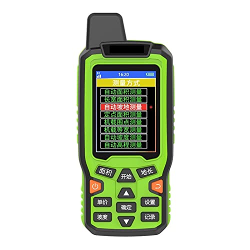
- Multiple Coordinate Formats: Easily convert and customize coordinate systems as needed. Create routes using waypoints, allowing you to efficiently reach your destination by following the designated route step by step.
- Outdoor Navigation: Supports navigation for waypoints, routes, and tracks, offering various navigation methods. The return route feature effortlessly guides you back along your original path. The built-in barometer provides elevation measurement for enhanced accuracy, while automatically detecting slope.
- Versatile Functions: In addition to area and length measurement, the device allows you to set points and measure acreage simultaneously. With a large 16GB memory capacity, you can save and export data at your convenience.
- Four Satellite Systems: Capable of receiving signals from BeiDou, GPS, GLS, and GZS satellites simultaneously for faster positioning and improved accuracy, ensuring you have coverage with no blind spots.
- Engineering Point Search: Input known coordinates directly to navigate and find desired locations. Easily edit and save names for quick referencing, making record-keeping hassle-free.
Features
Product
Product Name
Handheld GPS Navigator for Outdoor Surveying, Area and Length Measurements, Elevation Tracking, CAD Mapping and Data Export for Forest, Farmland, and
Brand
Generic
Series
Electronics
Category
Sports & Outdoors
Product Properties
Model
A-1
Part Number
KM-cdZZOp
Unit Count
1
You may also like